


Industry · Engineering Consultancies
Survey data engineerscan actually build on
Topographic survey, BIM-ready point clouds and documented accuracy statements for engineering consultancies across the UAE: structured to drop into your design environment without a week of cleanup.
The problem with most survey deliverables
Engineering consultancies rarely complain that drone data is unavailable. They complain that it arrives unusable: an enormous unregistered point cloud, no accuracy statement, no coordinate system documentation, and a format that needs converting before anyone can open it.
AIN UAE processes in-house and issues to engineering standards: registered, geo-referenced, in your project coordinate system, with the survey method and achieved accuracy documented in the report. What a design engineer needs from a point cloud is the thing we optimise for.
Pain points
What this industry keeps running into
Point clouds that arrive unusable
Unregistered, mis-scaled or wrongly projected data that costs days of remedial work before design can begin.
No documented accuracy
Deliverables issued without a stated accuracy or method, which cannot be relied upon or defended in a design submission.
Topographic surveys that hold up design
Ground survey crews are slow and expensive on large or difficult sites, and the topographic model becomes the programme bottleneck.
Format conversion overhead
Data supplied in proprietary or non-standard formats that require third-party conversion before it reaches Revit or Civil 3D.
The AIN UAE approach
How AIN UAE supports consultancy workflows
Topographic & contour survey
Full-site DTM/DSM with contours generated at your specified interval and coordinate system.
Registered, documented point clouds
RTK/PPK capture validated against ground control, with achieved accuracy stated in every survey report.
BIM-ready model preparation
Deliverables structured for Revit, Civil 3D and Bentley so scan-to-BIM begins immediately on receipt.
Clash detection support
As-built reality data supplied for comparison against design intent to surface clashes before they reach site.
Deliverables
What you actually receive
Every engagement ends in files your team can open and act on, not a folder of raw imagery.
- ◆ Digital Terrain & Surface Models (DTM/DSM)
- ◆ Contours at specified interval
- ◆ Registered point cloud (LAS, E57, RCP)
- ◆ Survey accuracy & methodology report
- ◆ Geo-referenced orthomosaic
- ◆ IFC-compatible model outputs
Measurable outcomes
What changes for the design team
Benchmarks reflect published industry data for drone-based survey workflows.
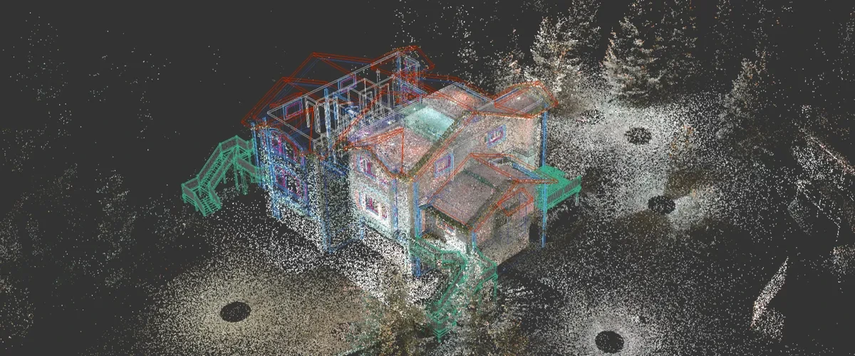
Registered, geo-referenced point clouds structured to drop into Revit, Bentley and Civil 3D without conversion.
FAQ
Engineering Consultancies · common questions
Centimetre-level positional accuracy is achievable using RTK/PPK positioning validated against ground control points. Every survey report documents the method used and the accuracy actually achieved, so the deliverable can be relied upon and defended in a design submission.
Yes. Data is delivered in the project coordinate system and datum you specify, including local UAE grids, so it aligns with existing survey control without transformation.
Yes. Ground control is placed and surveyed as part of the mission wherever the accuracy specification requires it, and the control network is documented in the deliverable.
Yes. Registered point clouds are issued in RCP and E57 structured specifically for scan-to-BIM workflows in Autodesk Revit and Bentley environments.
Scope your project in one call
Tell us the asset, the deadline and the deliverable format: we’ll map the mission. GCAA & DCAA licensed. We respond within 24 hours.