


Field-proven work
Proof,not promises.
Every project below was flown, processed and delivered across Dubai, Abu Dhabi and the wider UAE by the same in-house team. The footage is the deliverable: judge us by it.
01 · Infrastructure
Road & Bridge Modeling Capture
Challenge: A civil infrastructure owner needed deck, soffit and corridor condition data without lane closures or rope-access teams.
Solution: Corridor photogrammetry and structural capture missions flown under GCAA permits, processed in-house into a geo-referenced 3D model with defect tagging.
Result: BIM-ready deliverables in days, a defect baseline for future deformation monitoring, and zero traffic disruption.
02 · Energy
Thermal Data Analysis & Capture
Challenge: Live industrial assets suspected of thermal anomalies, with no shutdown window available for manual inspection.
Solution: Radiometric thermal capture across the asset envelope, anomaly classification and severity mapping, flown around live operations.
Result: Hotspots identified and prioritised before failure, with a time-stamped thermal baseline for the next cycle.
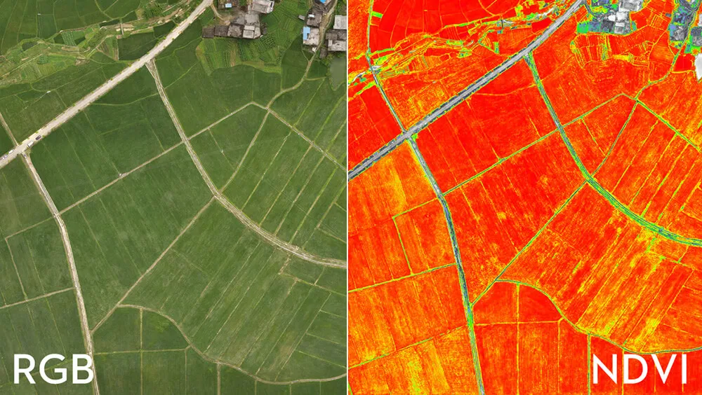
Spectral band capture rendered as crop-health zones.
03 · Agriculture
MultiSpectral Agriculture Solution
Challenge: A UAE agricultural operator was losing yield to crop stress that only became visible after damage was irreversible.
Solution: Scheduled multispectral flights producing NDVI and stress-index maps, with variable-rate zone files for irrigation and fertilisation equipment.
Result: Stress zones flagged weeks before visual symptoms, water directed where it pays, and a season-over-season benchmark.
04 · Construction
Construction Progress Monitoring
Challenge: A developer needed defensible proof of build progress across a multi-block residential city, without sending survey crews across an active site every month.
Solution: Repeat drone survey missions on a fixed cadence, each processed into a geo-referenced 3D reconstruction so any two dates can be compared like-for-like.
Result: A time-stamped visual record of roofing, solar and paving works completing across the site. Drag the slider to compare an earlier survey against a later one.
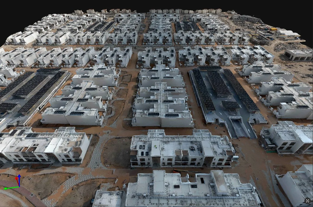
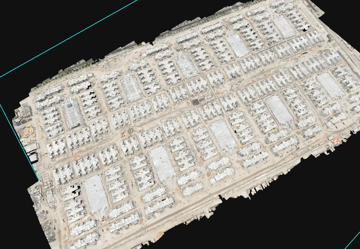
Two survey dates of the same residential city, aligned for like-for-like progress comparison.
Ready to see your asset in data?
Book a free consultation. GCAA & DCAA licensed. We respond within 24 hours.