


Industry Insights · 7 min read
Inside Abu Dhabi's Dh55 billioninfrastructure programme
24 projects, 300km of new roads, three regions at once. At this scale, the quality of your progress record decides how expensive the disputes get.
Published 21 July 2026 · AIN UAE
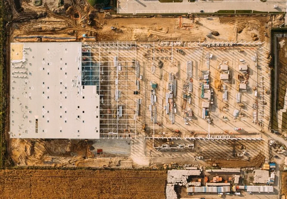
Multi-site programmes generate progress data faster than manual survey crews can document it.
What is actually in the programme
Abu Dhabi has announced a Dh55 billion Public-Private Partnership programme funding 24 new infrastructure projects across 2026 and 2027: one of the largest such initiatives the emirate has run. Roughly Dh35 billion is earmarked for transportation and roads alone, covering more than 300 kilometres of new roads, bridges, tunnels and major intersections across Abu Dhabi, Al Ain and Al Dhafra.
It follows Dubai's own AED18 billion package of infrastructure and urban development projects announced in the same period, and sits alongside continued momentum from Moody's confirmation that most UAE projects remain on track for 2026–2027 delivery despite regional supply chain pressure.
The package spans new residential communities, road networks, bridges and tunnels, and educational and healthcare facilities, structured to support urban expansion across three regions simultaneously. That geographic spread is itself a challenge: teams delivering in Al Dhafra face different site conditions, subcontractor pools and inspection logistics than teams in central Abu Dhabi or Al Ain, even reporting into the same PMO.
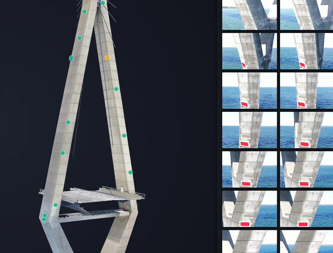
The operational reality behind the headline figures
For contractors, PMCs and engineering consultancies, the headline figures matter less than what they imply operationally: a large number of concurrent, multi-year, multi-site programmes, running at a moment when Dubai Law No. 7 of 2025 has brought every contractor in the emirate, free zones included, under a single registration regime, and when material costs are pushing procurement and cost control higher up the risk register.
The practical reality is less one big project and more several large projects running at once, each generating its own trail of progress data, variations and as-built records that eventually need to reconcile with a single programme-level view.
The documentation burden nobody budgets for
Every one of these projects will generate disputes, variations and warranty questions over its lifecycle. What determines how expensive those become is usually the quality of the record kept along the way. A monthly progress photo taken from ground level, filed in a shared drive, rarely holds up when a client or arbitrator asks exactly what the site looked like on a specific date, from a specific angle, at a specific stage of works.
Programmes at this scale also compress timelines for as-built verification. When 300 kilometres of roads, bridges and tunnels are delivered in overlapping phases, manual survey crews become a scheduling bottleneck: site access coordinated, lane closures negotiated, and survey data processed and formatted before it is usable downstream.
Progress monitoring as risk management
The contractors and PMCs who come out of a programme like this with the fewest cost overruns tend to share one habit: they treat progress documentation as risk management, not paperwork. A geo-referenced, time-stamped aerial record, captured on a consistent schedule and structured against the programme timeline, does three things a written report cannot.
- It gives every stakeholder, from the client's PMO to the engineering consultant to the contractor's QA team, the same visual evidence of progress, reducing argument over whose version of events is accurate.
- It creates a defensible record for variation claims and delay analysis: evidence of exactly what was and was not in place at a given milestone date.
- It feeds directly into BIM and digital twin models, so progress data does not have to be re-captured or reformatted at handover.
On multi-site programmes of this kind, that record is far easier to build with drone-based aerial survey and photogrammetry than with ground crews alone: particularly across large linear assets like roads, bridges and tunnels, where full ground-level coverage is slow and disruptive to traffic.
Practical steps for teams mobilising now
- Agree the survey and reporting cadence with the client before mobilisation, not after the first dispute. Monthly aerial capture aligned to programme milestones is a reasonable default for large linear and civil works.
- Specify BIM-compatible output formats (Revit, Bentley, Civil 3D) in the contract data requirements, so as-built data does not need reprocessing at handover.
- Centralise inspection and progress records in a single platform accessible to PMC, consultant and contractor, rather than emailing PDFs between teams on different sites.
- Build the as-built record incrementally through the programme, rather than reconstructing it retrospectively at completion.
For how this works in practice on active sites, see our approach for construction and contracting and for civil infrastructure owners.
About AIN UAE
GCAA & DCAA licensed drone data and digital twin company
Based in Dubai, working with developers, PMCs, engineering consultancies and facilities teams across the UAE and GCC. We build asset-level digital twins from drone photogrammetry and thermal data, delivered in formats that plug directly into Revit, Bentley and standard GIS platforms.
Talk through your portfolio