


Construction · 6 min read
Beyond the blueprint:how drone progress monitoring accelerates Gulf mega-projects
GCC mega-projects run on billion-dirham margins where a missed delay compounds fast. Automated drone progress monitoring turns unpredictable jobsites into transparent, data-driven environments.
Published 1 August 2026 · AIN UAE
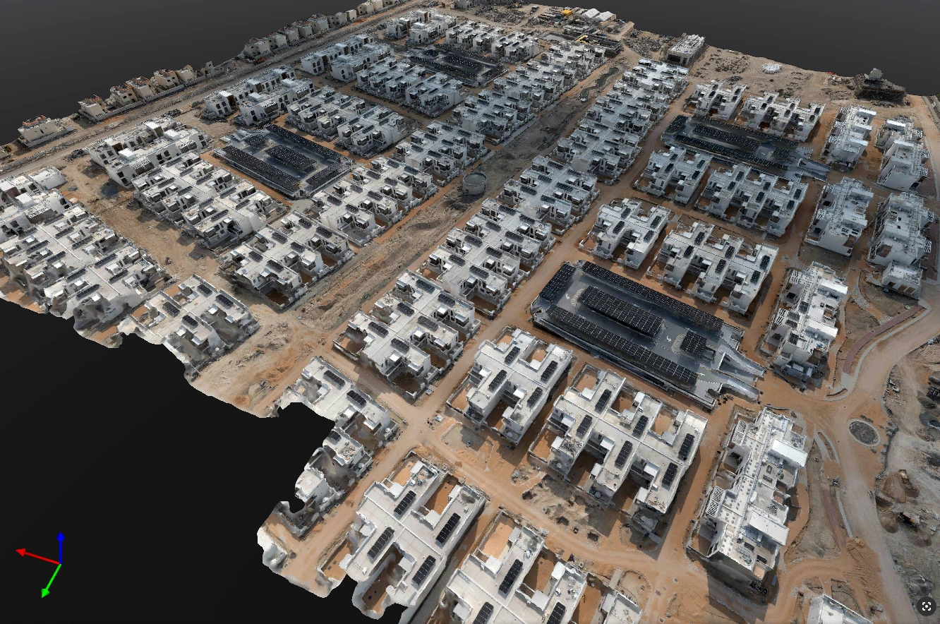
Weekly automated drone flights build a time-lapse record of construction progress from identical coordinates.
Continuous visibility: weekly aerial visual audits
Traditional construction surveys are slow, often requiring days to measure a large footprint. By the time a manual report reaches the stakeholder's desk, the site data is already outdated. Drones compress this timeline into hours. Flying pre-programmed, automated paths weekly or bi-weekly, commercial drones capture complete visual records of a site from identical coordinates every time, creating an accurate time-lapse chronicle of construction evolution.
- Instant verification: Project Management Consultants (PMCs) can verify contractor milestones against on-site reality before releasing payments.
- Remote collaboration: remote developers or global investors can inspect interactive site maps from anywhere, eliminating the need for frequent in-person site visits.
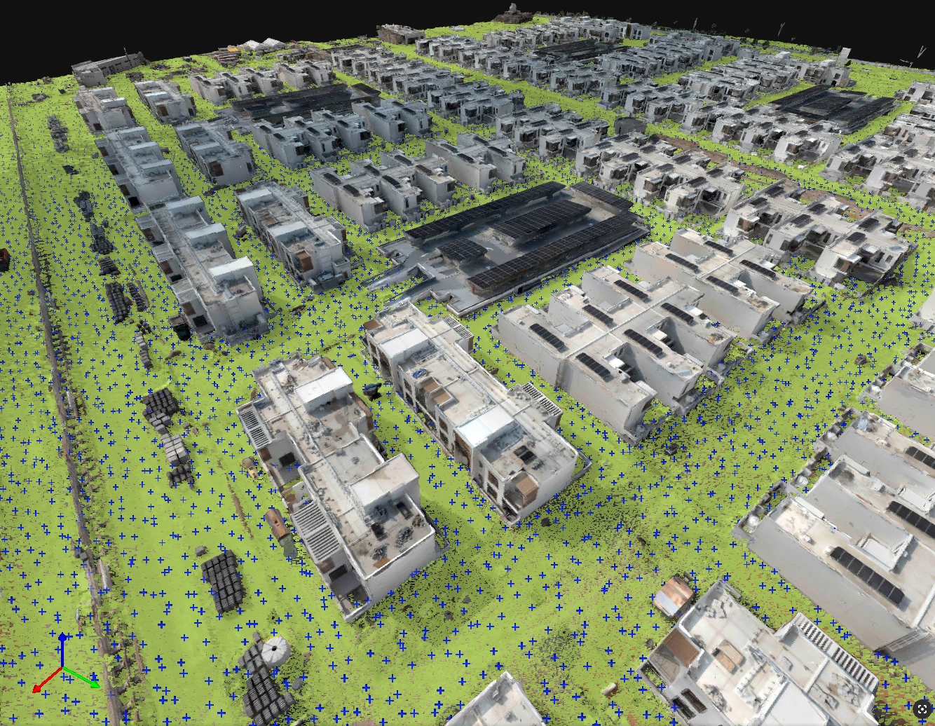
Earthwork volumetrics in minutes, not days
Accurately tracking cut-and-fill operations is one of the most contentious aspects of civil engineering. Relying on survey crews to calculate the volume of massive stockpiles or deep excavations takes days of traversing hazardous terrain. Equipped with high-precision RTK sensors, AIN UAE drones capture millions of data points to generate accurate 3D point clouds and digital terrain models.
- Volumetric calculations: software instantly calculates stockpile volumes with centimetre-level precision.
- Dispute resolution: managers gain exact, verifiable data on material movements, eliminating billing disputes between developers and earthwork subcontractors.
BIM integration: spotting costly deviations early
The true power of drone data lies in bridging the gap between design and reality. The aerial maps and photogrammetry models integrate directly with existing Building Information Modeling (BIM) software such as Autodesk Revit or Civil 3D. By overlaying the as-built drone data on top of the as-designed CAD or BIM blueprints, engineers can perform immediate clash detection:
- Identify structural misalignments or foundation deviations before concrete cures.
- Ensure utility corridors, access roads and drainage networks match exact design coordinates.
- Catch errors during early phases when they cost thousands to fix, rather than later when they cost millions.
Secure your construction lifecycle
In the fast-paced landscape of UAE infrastructure, staying on schedule is the ultimate competitive advantage. Drone progress monitoring takes the guesswork out of site management, replacing assumptions with absolute, unarguable geospatial data. By partnering with a licensed provider that manages all GCAA/DCAA clearances and strict safety protocols, you keep your project protected and on track. See how construction and contracting teams put this to work.
About AIN UAE
GCAA & DCAA licensed drone survey and mapping company
AIN UAE is based in Dubai, working with contractors, PMCs and developers across the UAE and GCC. We fly progress-monitoring, volumetric and as-built surveys in-house and deliver them in BIM-ready formats that drop straight into Revit, Civil 3D and Navisworks. One team, one contract, from flight to model.
Scope your site monitoring