


Agriculture · 6 min read
Precision ecology:drone analytics for GCC agriculture & environment
From desert agri-tech to 100-million-mangrove restoration pledges, managing vast natural assets needs oversight ground teams cannot scale to. Multispectral drone analytics turn light invisible to the eye into predictive intelligence.
Published 1 August 2026 · AIN UAE
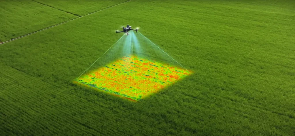
Multispectral capture renders crop stress and vegetation health long before it is visible on the ground.
Maximising yields with NDVI crop monitoring
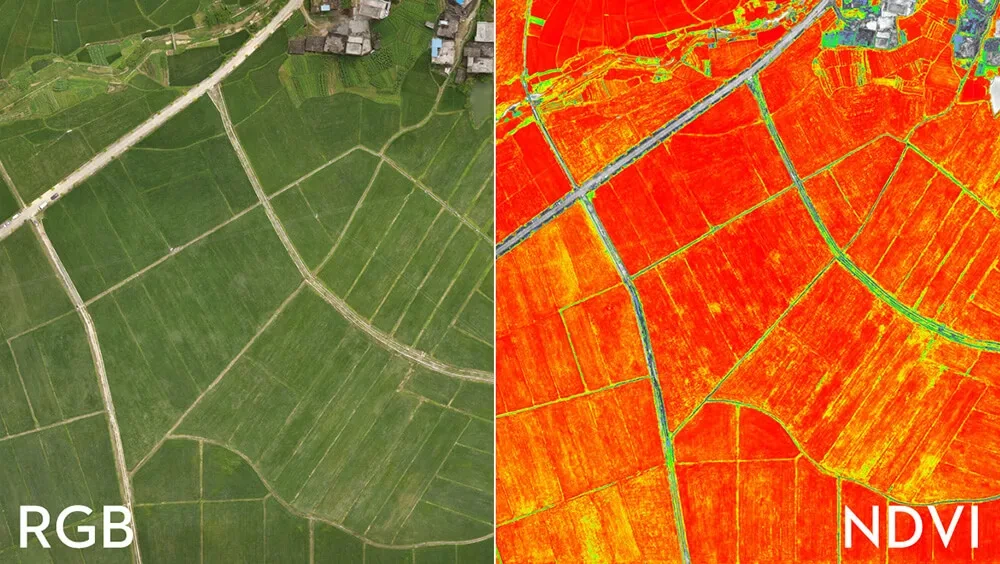
In commercial desert farming, irrigation efficiency and early stress detection dictate the success of a harvest. Waiting until crops visually turn yellow or wilt means the damage has already occurred, leading to inevitable yield loss. Equipped with multispectral sensors, AIN UAE drones capture data across specialised bands including Near-Infrared (NIR) and Red Edge, used to calculate the Normalised Difference Vegetation Index (NDVI).
- Chlorophyll tracking: NDVI maps measure chlorophyll absorption within plants, letting farmers identify crop stress days before it shows visually.
- Targeted interventions: instead of treating an entire 100-hectare field, growers pinpoint exact zones suffering irrigation failure, pest infestation or soil-nutrient deficiency, saving water and fertiliser.
Safeguarding mangroves and coastal ecosystems
Mangrove forests are the UAE's natural defence against carbon emissions and coastal erosion. Government mandates like the UAE's pledge to plant 100 million mangroves require meticulous long-term survival monitoring. Manually tracking these swampy, tidal zones is logistically hazardous and imprecise. Drones offer a non-invasive, high-frequency surveying solution:
- Canopy and stand counts: high-resolution orthomosaics let environmental scientists automatically count individual saplings and track growth over multi-year cycles.
- Tidal and hydrological modelling: high-precision digital terrain models map tidal channels, ensuring water channels stay clear to support newly planted vegetation.
Tree counting and health audits for carbon credits
As regional corporations invest heavily in carbon offsetting and urban forestry programmes, proving the physical footprint of environmental assets is essential: you cannot monetise or report carbon sequestration without verifiable data. Using specialised machine-learning algorithms paired with drone data, AIN UAE delivers automated tree-canopy identification:
- Mass-scale audits: accurately count tens of thousands of date palms or urban trees in a single flight day.
- Volumetric biomass: estimate tree height and canopy volume to calculate carbon-storage metrics with institutional-grade accuracy.
Future-proof your environmental assets
Sustaining agriculture and ecology in arid environments requires a departure from reactive land management. Multispectral aerial intelligence equips your agronomy or conservation teams with the data-driven foresight required to optimise resources and guarantee project survival. See how agricultural operators scope a first survey.
About AIN UAE
GCAA & DCAA licensed multispectral drone survey company
AIN UAE is based in Dubai, working with agricultural operators, agri-tech firms and environmental agencies across the UAE and GCC. We fly NDVI and multispectral surveys, tree-canopy audits and coastal-ecosystem monitoring in-house, delivered as agronomist-readable reports and zone files that drive real interventions.
Discuss your land portfolio