


Aerial Mapping · 6 min read
Accelerating Dubai South master planswith aerial drone mapping
The southern corridor of Dubai is undergoing a monumental transformation. Across Dubai South, Expo City and the surrounding commercial master plans, developers are building cities of the future over vast stretches of desert — and the infrastructure phase sets the cadence for the entire project lifecycle.
Published 14 August 2026 · AIN UAE

Fixed-wing mapping drones compress months of ground survey over Dubai South into a handful of flight days.
The southern corridor of Dubai is undergoing a monumental transformation. Led by the rapid expansion of Dubai South, Expo City Dubai and the surrounding commercial master plans, developers are building cities of the future across vast stretches of desert.
When managing a multi-square-kilometre development, the infrastructure phase sets the cadence for the entire project lifecycle. Relying on legacy land-surveying methods over thousands of hectares causes systemic bottlenecks. Traditional ground crews can take months to complete baseline topographic maps, stalling grading work and delaying the launch of off-plan phases. To keep pace with aggressive timelines, master developers are leveraging large-scale, high-accuracy aerial mapping to unlock rapid infrastructure deployment.
Compressing months of work into flight hours
Traditional topographic surveying requires land surveyors to manually shoot points across vast terrain. On a mega-project scale, this introduces significant delays and compromises data density. Fixed-wing and multi-rotor mapping drones completely shift this workflow. Flying systematically over the site, drones capture thousands of high-resolution images embedded with real-time RTK/PPK geotags.
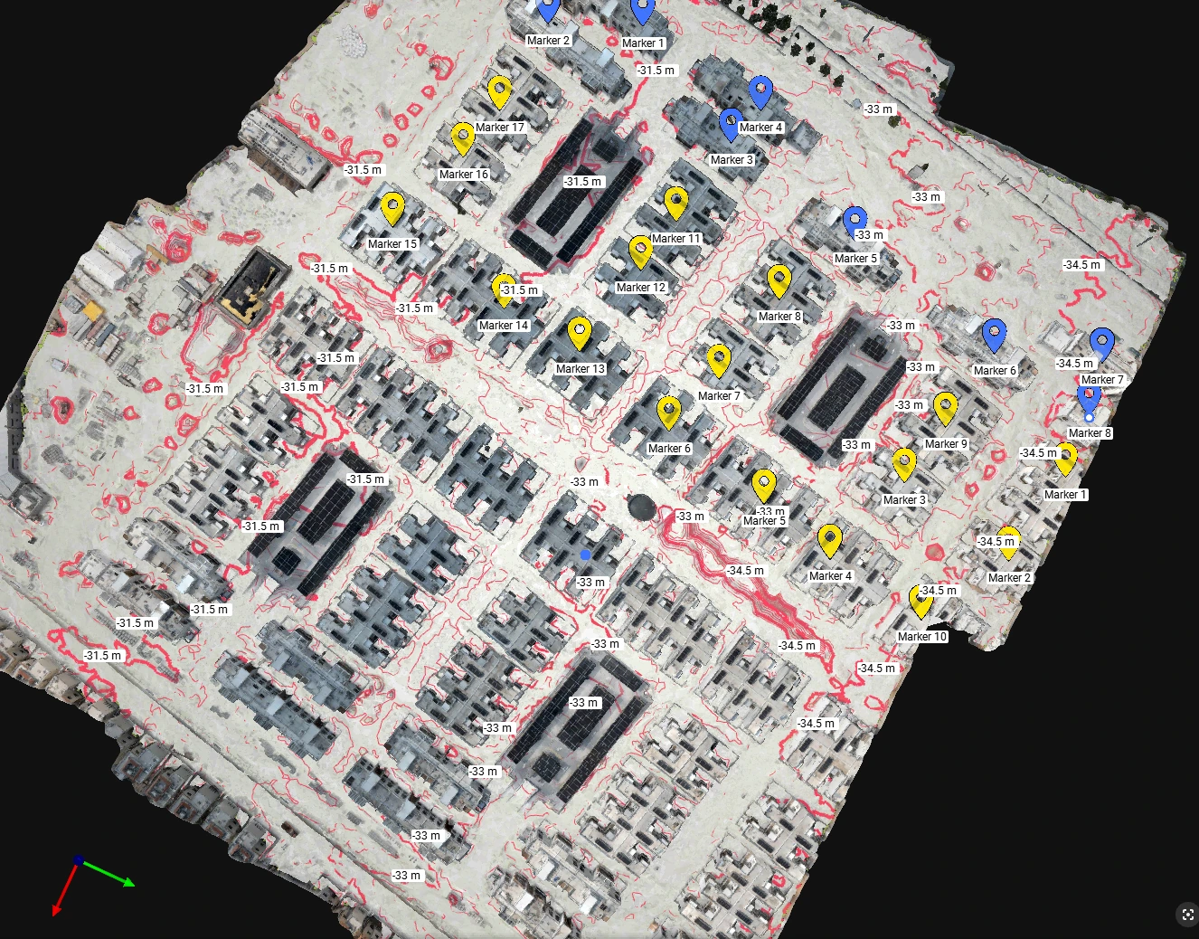
Massive coverage: a single drone deployment can map hundreds of hectares in one flight day. Unparalleled data density: instead of a sparse grid of manual data points, drones produce dense point clouds and high-resolution orthomosaic maps, where every pixel carries precise coordinate data.
Elevating infrastructure accuracy with GIS integration
The raw visual data captured by drones is processed into highly accurate, engineering-grade GIS (Geospatial Information Systems) layers. For design consultants and civil engineers shaping Dubai South infrastructure, this delivers distinct operational advantages:
Flawless volumetric insight. Instantly calculate the precise volume of earth required for cut-and-fill balances across uneven desert terrain, avoiding unexpected hauling costs. As-built infrastructure audits. Map utility corridors, road grading and drainage assets as they are laid, confirming they align with design plans before they are covered. Seamless BIM overlays. Drop aerial orthomosaics directly into software like Civil 3D or Autodesk Revit to allow design adjustments based on real, live terrain data.
Delivered as a living digital twin of the site, that same data set keeps feeding the project long after the baseline survey — each new flight measured against the last.
Delivering the strategic edge
In the fast-moving UAE real-estate market, launching a master plan even a few weeks ahead of schedule translates to millions in captured market interest. Aerial intelligence gives master developers the rapid clarity needed to clear land, verify civil works and unlock off-plan sales milestones with confidence. It is the same photogrammetry and 3D mapping workflow we run across large-footprint UAE developments.
About AIN UAE
High-accuracy drone mapping for UAE master-plans
AIN UAE delivers survey-grade aerial mapping, orthomosaics and GIS-ready deliverables for master developers, design consultants and civil engineers across Dubai and the GCC. We fly RTK/PPK photogrammetry over large development footprints and hand back BIM-ready data in the formats your engineering stack already uses. If you are grading a new master-plan phase, we can map it in flight days, not months.
Map your development footprint